 |
||
|
Daily Log, May 15 Sunday May 15, 2005 |
||
Morning Position |
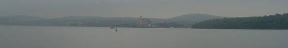
Midday Position Tompkins Cove 41˚ 16.5' latitude 073˚ 57.7' longitude |
Evening Position Beacon 41˚ 30.5' latitude 073˚ 59.5' longitude |
0600 It is definitely foggy, but no rain yet. The decks are wet from the rain last night. Today we will review line handling and conduct training in the use of the safety harness. The student groups will also begin their research projects; the Port Watch will study the weather and the Starboard Watch will study the water. Each team will start working with their equipment before lunch.
|
||
0830 The sky actually cleared a bit during breakfast, putting us all in a good mood. We are ready to get going with the work at hand. It is amazing that there can be so much to learn about things that we ordinarily think so little about. For example, rope. Who would know that there is a right way and a wrong way to coil a length of rope? And when would anyone pay enough attention to a piece of rope to figure out how it is made? Well, when your life and safety depend upon it, such small things can really become important. When we look up we see a yard that weighs many hundreds of pounds, and if it came crashing down, it would do major harm to people. So we pay attention to lots of otherwise trivial things that really are important to us now. |
||
|
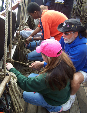
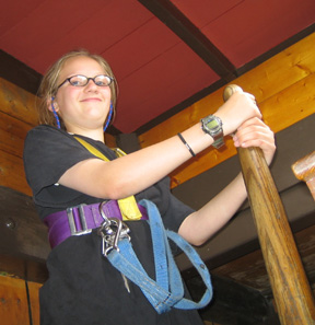
0930 Getting into a safety harness is hardly trivial, but who would ever know that it involves so many important steps? The buckle must be connected just right, the fit must be adjusted just so, and even the angle of the straps must be level across your back. Only after all this can we think of going aloft.
|
||
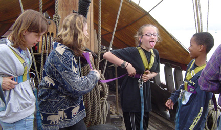
Once the students learn how to properly get into a safety harness, they can check each other to make sure their straps are secure, just as Sam and Ginny are doing here. |
||
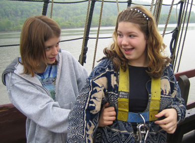
Andi seems to think her harness is on a little too tight. |
||
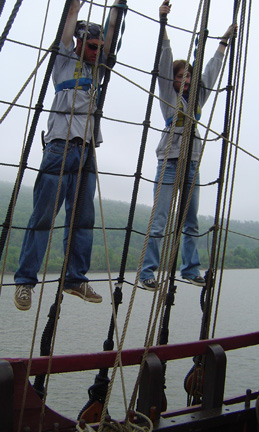
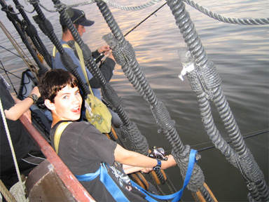
Even then, we must follow precise steps in how we enter the rig. Once there, it is a great experience, even if you are kind of anxious at first. Before any crew member is cleared to go aloft in the rigging, they must perform a hang test. Mr. Dawson is leading Sam through her hang test here. In a hang test, the crew member hangs just from their hands for several seconds. This tests their upper body strength and gives them a clear idea of how tight a grip they need to keep on the rigging to hold themselves up just in case of a slip. |
||
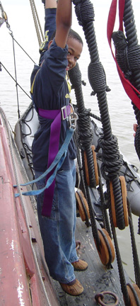
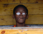
Some students perform their hang tests a little higher up in the rigging than others. (Actually Jamal is just having a little fun with his test.) Another good thing about the Half Moon is that no one is required to go aloft -- only those who are interested in climbing the rig do so. Although many crew members enjoy climbing the rig (even those who initially find it intimidating), we have also had many invaluable crew members onboard whose feet remain on deck.
|
||
1000 Mr. Linehan opens the education lab today. Much of the equipment that we have access to came from a special grant by the W.K. Kellogg Foundation; it sure makes a difference to have this gear aboard. We spend the morning getting used to working with the equipment, and expect to begin our studies tomorrow.
|
||
|
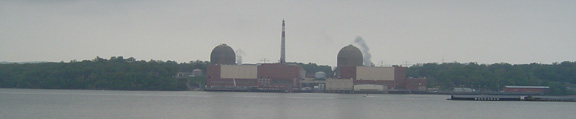
1100 Tompkins Cove, where we are anchored, is right across from Indian Point, where there is a nuclear reactor. Tompkins Cove is where the military once had a reserve fleet. A reserve fleet is ships that are no longer in service, but are kept in reserve until they are needed. Captain Reynolds said that once before when anchored there the anchor had fouled on debris from the reserve fleet which took a long time to remove.
It is interesting to look at the old charts and photographs of the area and compare what it was like in the past with what is there today. The chart we have from the 1630s shows a good picture of the river; the depths are even very much the same. Photographs from the 1920s are interesting, also. You can bet it looked very different then, but not always nicer. Many places actually look better today. It is interesting to compare the views and see things differently; in tomorrow's log, we will show how the Newburgh shoreline has appeared over the years.
|
||
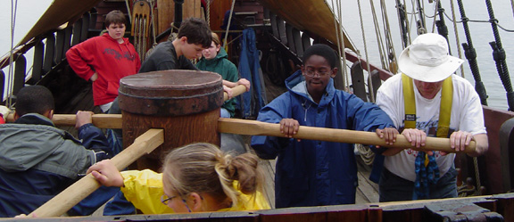
1130 We discuss how to raise the anchor. It is a complicated process, and is done just the way it was 400 years ago -- turning a capstan that winds the anchor rope in, as most people have seen in the movies. It takes about twenty minutes to describe what to do, and then another twenty minutes to haul in the 150 feet of rope and 50 feet of chain that we had out on our anchor. Our anchor also dredged up a section of waterlogged burlap from the bottom, which Mr. Dawson had to tear away. |
||
|
While one team turns the capstan, another group of crew members works down on the orlop deck to ensure that the anchor line doesn't snag, and then to flake (carefully fold back and forth) the anchor line so it can quickly be used again if need be. |
||
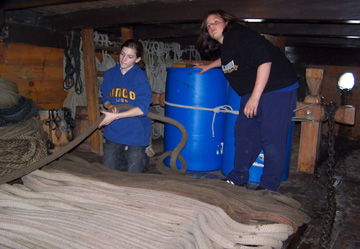
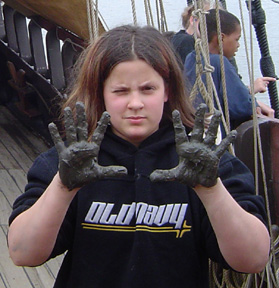
After spending the night on the river bottom, the anchor chain often comes up covered in thick mud, which smears all over the orlop deck. Washing it all away is a messy job, but with everyone's help it gets done quickly. Our plan was to sail off the anchor, but the wind died completely. Maybe later in the day we can sail. At 1230 we are headed north and eating lunch. 1300 We pass the Bear Mountain Bridge. Captain Washington is in charge of the watch now. The crew rotates from Port Watch in the morning to Starboard Watch in the afternoon, to anchor watch at night.
|
||
|
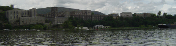
1445 We are approaching West Point. The mountains are getting higher, just like it said in Juet’s Journal, the log of the original Half Moon.
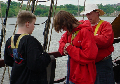
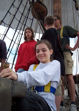
Each student crew member is getting a turn steering the ship by using the whip staff. The whip staff is a long pole that is attached to the tiller coming off the rudder. The whip staff passes through the deck, where it can swing back and forth. Pushing it one way pushes the rudder and steers the ship. The Captain tells us that on the Half Moon the rudder only moves about 15 degrees, but that on a modern ship the rudder would move more than 35 degrees to each side.
Sometimes, being at the helm requires intense concentration.
|
||
1510 We are going past Storm King, an impressive mountain on the western side of the Hudson River, and the end of the Hudson Highlands. Newburgh Bay is beyond. With luck we will get to sail in Newburgh Bay.
|
||
|
1600 The sails are set and the engine is shut down. Each mast has two sails, a course and a topsail. In the bow is the spritsail, and in the stern is the lateen mizzen. It is quite complicated with all the lines, but after sailing yesterday and practicing with the lines, the crew is getting the hang of sailing. The light winds make this easier, but also mean that we will not be able to try some things that we want to. However, we are bracing the yards and then setting and dousing the sails one after another. It takes some real concentration to get this done well. Captain Reynolds tells us that we are doing very well, especially for never having done this before. Captain Berg, who spends the afternoon working the spritsail with Jamal, believes his young crewmate may have already mastered its lines.
|
||
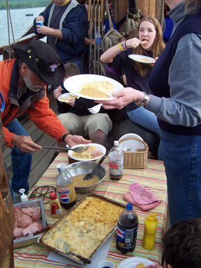
1830 The anchor is set, at 41degrees 30.5 minutes latitude; 073 degrees 59.5 minutes longitude, or just off Beacon. Furling the sails does not take long, and Mrs. Barton’s dinner of ham, cinnamon applesauce, and scalloped potatoes really hits the spot.
|
||
After dinner, we discover that we have several dedicated fishermen in our midst. As the sun sets, Mr. Dawson and Dylan fish from the channel. No catches to report so far, however. |
||
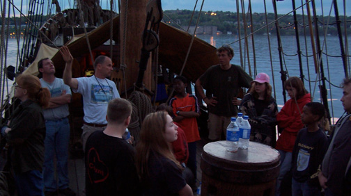
2000 At anchor watch briefing we discuss storm clouds and lightning; we can see the different types of storm clouds around us, and learn what they each mean. As Captain Reynolds spoke, we could see a squall front blowing in, with lightning flashing in the clouds just over the horizon. We could also see the points that we would use for reference tonight to tell if the ship drags anchor. With each night that passes, our new crew members on anchor watch grow more comfortable with the ship's movement with the wind and tide and can sense more accurately whether we are adrift.
|
||