 |
||
|
Daily
Log, May 16 Monday May 16, 2005 |
||
Morning Position |
Midday Position Beacon 41˚ 30.5' latitude 073˚ 59.5' longitude |
Evening Position |
|
|
||
|
0410 More squalls pass to the north of us, and the rain is steadier. But the anchor is holding well, and the ship is stable. The wind is blowing one way and the current flowing the other, so the ship is laying broadside to the wind and current, with no strain on the anchor line.
|
||
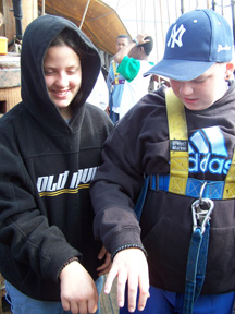
0700 It is definitely cooler at breakfast, and still cloudy, but the rain has stopped. After breakfast (eggs and ham on English muffins – tasty) we will continue with our educational projects, and plan to raise the anchor in the late morning. Captain Berg worked with us to learn how to make a bracelet from small lines, and some of us made these bracelets before breakfast. They look pretty cool.
|
||
|
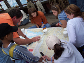
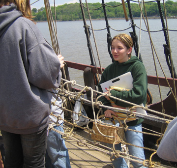
0900 We have begun the work on our studies of water and weather. This morning we will concentrate on checking clarity of water, measuring the depth of the water, and recording the temperature, barometric pressure and wind speed. These measures will be an important part of our team studies of water and weather phenomena. We will work on more measurements when we are underway this afternoon. The wind is from the north, so we will most likely have to motor north along the Long Reach; this is the stretch of river from Beacon to Norrie Point. Even Hudson called it the Long Reach, and it is labeled the Lange Rack on the chart we have from the 1630s.
|
||
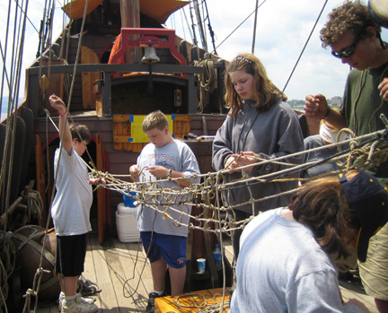
After we finish our studies, Captain Berg starts working with us on making a hammock. We are using scraps of rope --and long lengths of hope -- to finish the hammock so we can use it.
|
||
Having brought his fishing rods, Dr. Dawson continues fishing with Dylan. Jamal soon joins in. (Later on, even Captain Washington borrows a rod to cast a few lines.) Dylan and Jamal are hoping to catch a striper, but will be happy to settle for a catfish. We will see. Soon we will start weighing anchor (if we can get the hammock project out of the way!).
|
||
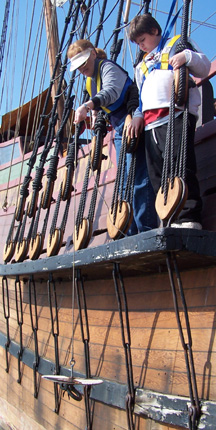
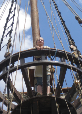
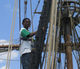
1100 Work aloft continues, with Jamar and Andi in the main top.
|
||
1200 Conflict! It is inevitable on a small ship. Yet here we are, with the hammock strung over the lunch area! What to do? Sorry, folks, but lunch wins. |
||
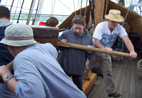
1340 Anchor’s aweigh! Captain Reynolds even comes down from the quarter deck to lend his weight to the capstan. With the anchor secure, the ship is underway, northbound. The wind might be favorable for sail, so once we have the anchor secure, we climb aloft to unfurl.
|
||
|
1350 We pass the Newburgh Beacon Bridge and take a heading off Danskammer Point. The sky is clear, and no sign of rain, even though it is forecast for later.
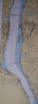
We can then compare this with a modern chart to compare and contrast their accuracy. For reference, "Pollopels Eylandt" on the 1630s chart is still named Pollepel Island on our modern chart. |
||
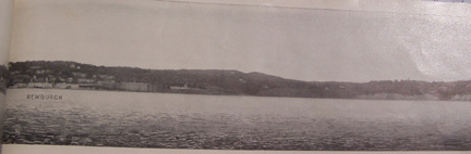
We can also see what the Newburgh riverside looked like at the beginning of the 20th century. This image comes from an interesting book that Mr. Linehan brought. Titled Panoramic Views of the Hudson, it was published in 1906 and was sold on the Hudson Day Line steamships of the era. |
||
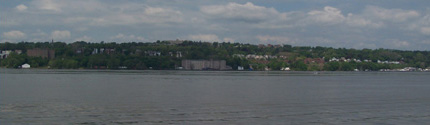
Lastly, we can see what Newburgh looks like today just by using our eyes. Much of the city has changed, but a few easily noticed landmarks remain. |
||
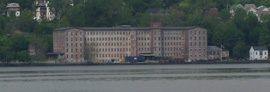
Can you find this factory in the images from both 1906 and 2005? |
||
|
1415 The sails are ready to set, but the wind holds northerly. We set and douse the sails for practice.
|
||
|
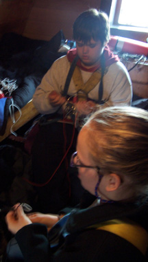
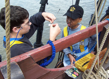
1500 We put the sails into their gear and set about other tasks on the ship. Between educational projects and ship projects, there is always something to do. Here, Mr. Linehan is teaching several students how to measure water salinity with a refractometer. The students can then use this information to accurately determine from where in the Hudson River various water samples would have been drawn. |
||
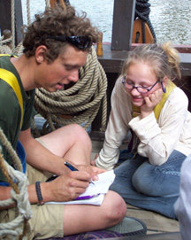
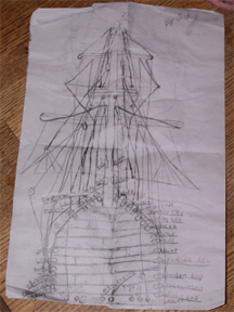
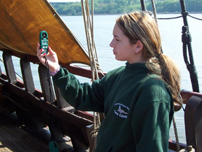
Andi, who is part of the team that operates the main sails, gets the idea to draw a diagram of the main mast's running lines. She recruits Captain Berg for help.
We are almost to Poughkeepsie, and are near a place that used to be called Lover’s Leap. This is a sharp cliff face, and it was just inland from here that Samuel F.B. Morse had his home (this information again comes from Panoramic Views of the Hudson).
|
||
1600 We are now passing the Esopus Lighthouse, built in 1871. The shallows to the west of the light caused many a ship to ground, starting with the Half Moon, which grounded here on September 17, 1609. Juet describes it in the log of the 1609 voyage: “… found shoalds in the middle of the channel, and small Ilands, but seven fathoms water on both sides. Toward night we borrowed no neere the shoare, that we grounded: so we layed out our small anchor, and heaved off againe. Then we borrowed on the banke in the channel, and came aground againe; while the floud ran we heaved off againe, and anchored all night.” That matter of fact account must have been quite scary; had the ship broken up, the crew would have been stranded here, with no hope of rescue from Europe. |
||
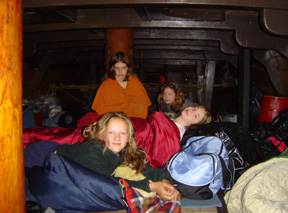
1800 Coming to anchor in the back channel opposite the shipping channel, just above the mouth of the Rondout Creek. Rondout comes from the Dutch word for a spar, or wooden yard or small mast. We are secure at 41 degrees 56.2 minutes latitude; 073 degrees 57.1 minutes, with a beautiful view towards the Catskills. For dinner, we have Captain Reynolds' favorite: chicken & biscuits. To give you an idea of how popular the dish was with the crew, the food was all gone before we could even snap a photo of it. Finally, the students bunk down on the orlop after a long day. The wind is blustery as the unstable cold front passes; we expect clear weather tomorrow.
|
||
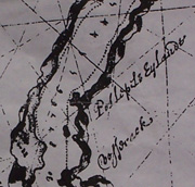
 In passing Newburgh, we can call on various resources to see how it has appeared from the river throughout its history. First, we examine our copy of a nautical chart that dates back to the 1630s (sorry for the fuzzy photos):