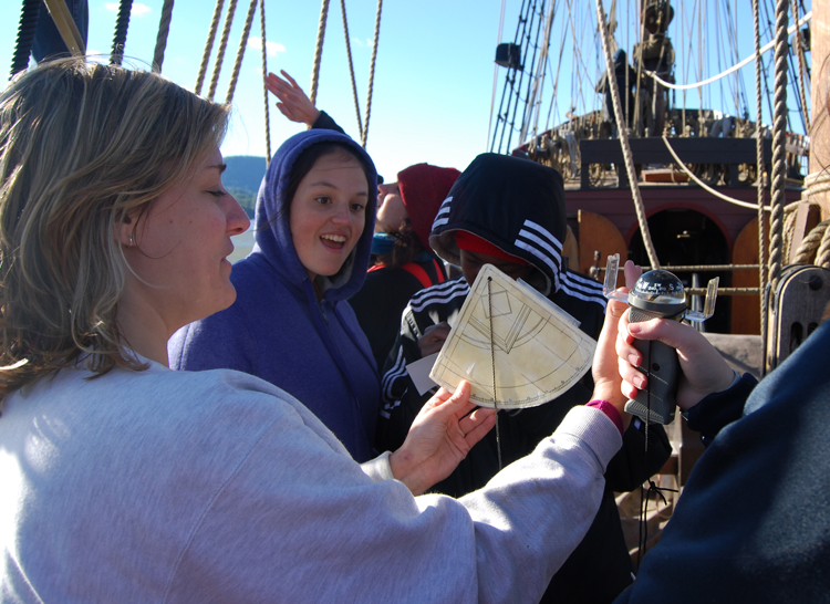
We use a traditional instrument called a quadrant (pictured) to measure the angle of celestial objects above the horizon. Captain Hudson himself would have used this instrument to determine his latitude (his position on the north-south axis of the globe). The quadrant is so named because it forms one quarter of a circle (a 90˚ angle). 0˚ represents the equator, while 90˚ represents the north pole. Gravity pulls the dangling plumb bob straight down toward the center of the Earth. A navigator in the northern hemisphere can look up along the quadrant's flat edge to observe Polaris, the north star; the resulting angle indicated by the plumb bob would then indicate the user's northern latitude. (These same measurements are used to record the ship's track throughout the voyage today.)