2007 Masters Voyage of Discovery banner

River Science: Celestial Tracking

In truth, the tracking of celestial objects is as much shipcraft as river science. In 1609 (and indeed, for thousands of years before that and to this very day), celestial navigation was a crucial aspect of nautical life.

We use a traditional instrument called a quadrant to measure the angle of celestial objects above the horizon; these include the Sun and various stars.

Captain Hudson himself would have used this instrument to determine his latitude (his position on the north-south axis of the globe). The quadrant is so named because it forms one quarter of a circle (a 90-degree angle). 0 degrees represents the equator, while 90 degrees represents the north pole. Gravity pulls the dangling plumb bob straight down toward the center of the Earth. A navigator in the northern hemisphere can look up along the quadrant's flat edge to observe Polaris, the north star; the resulting angle indicated by the plumb bob would then indicate the user's northern latitude (see the Daily Logs for our latitudes at each anchorage throughout the voyage).

Mouse over for a closer view.
Greg and Ross use a compass to mark the bearing of the rising moon at dusk.

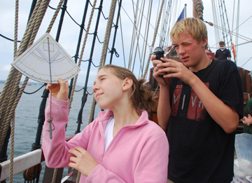
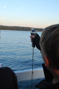
On this Voyage of Discovery, two seperate student teams chose to utilize celestial tracking for their presentation projects. Greg and Ross took on the challenge of tracking the Moon's course throughout the night, while Andrew and Lizzie chose to track the Sun. Unfortunately, overcast skies would ultimately force Greg and Ross to abandon their project in favor of a more controllable topic.

By tracking the Sun, we can determine local true noon (the point at which the sun is highest in the sky), which can differentiate from the local standardized time by nearly up to an hour, depending on one's location in a time zone. In the northern hemisphere, the direction of the Sun at local true noon in turn determines due south. The difference between the Sun's bearing and magnetic south is called the Sun's azimuth; thus, a celestial navigator could use a quadrant and the Sun's azimuth to calibrate a compass.

Of course, overcast skies can prove a serious annoyance, since they hide a navigator's celestial reference points. This holds true whether you're just trying to observe the sun for a project or a sailor lost at sea in the Northern Atlantic.

Voyage Homepage Our Crew Half Moon homepage