2009 Fall Voyage of Discovery banner

River Science: Salinity

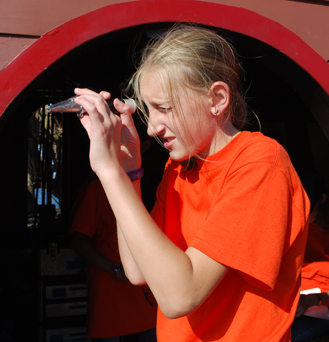
The Hudson River is an estuary: a freshwater river that flows into the ocean, where it mixes with salt water. The degree of mixture between fresh and salt water is called the salinity gradient. On the Hudson, the salinity gradient at a given location can vary considerably depending on factors such as time of year, tidal flow, and precipitation. Salinity levels have an immediate effect on the surrounding ecology, since many aquatic creatures can survive only in either "salt" or "fresh" water. It's just as important for sailors (of any era), who need a fresh water supply to survive.

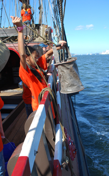
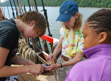
To measure the salinity gradient as we travel upriver, our students collect water samples at a series of predetermined locations, which our students find using landmarks (such as buoys and river markers) and GPS coordinates.


On the Half Moon, we collect water samples the old-fashioned way: by simply heaving a tethered canvas bucket overboard and hauling it back on board.

These water samples are then collected in sample jars for later analysis by the entire student crew. We continue to collect samples regularly until the salinity gradient consistently drops to zero, which is to say, until the water is completely fresh. On this leg of the voyage, our readings recorded fresh water shortly before arriving at Verplanck. Students on the next leg of the voyage will analyze this data.

Students use a refractometer to measure salinity levels using refraction: the degree to which light bends as it passes through different materials. Saltier water bends light farther than fresher water, so a trained refractometer user can check salinity levels with just a glance.

Sailors on board the original Half Moon in 1609 would have had to simply go by taste.

Voyage Homepage Daily Log Our Crew Learning Page Half Moon Homepage