 |
|
|
|
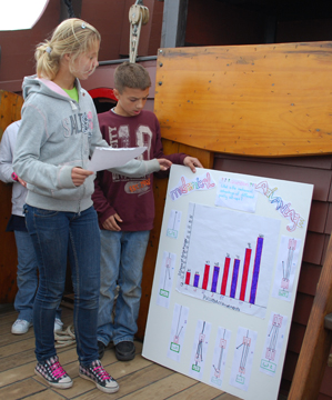
The final phase of the student projects was, of course, the presentation itself. The students spent the morning and early afternoon of Day Four graphing the data they had collected and preparing written reports on their materials, methods, and conclusions to accompany their oral presentations. Each presentation was also accompanied by a round of questions, in which the students considered possible sources of error and ways these experiments could be improved in the future.
|
Presentation Project Topics |
|
|
|
In the end, the students' experiments produced enlightening results. In every case, the students ended their Voyage of Discovery with a greater understanding of the natural world around them.
You can scroll down or use these links to jump directly to a topic.
|
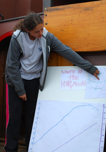
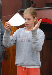
Research Team 1: Celestial Tracking
|
Students: Alyssa, Harmen, Kortnee, & Lauren
Senior Crew Advisor: Menno de Leeuw
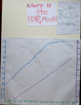
Guiding Question: Where is the Half Moon?
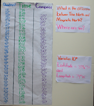
Instruments: Quadrant, directional compass, watch.
Conclusion: The celestial tracking team recorded the sun as having reached its zenith (the time of true noon) shortly after 1300 hours (1 PM), thanks to daylight savings time. Extrapolating from this and the sun's altitude at that moment, the team calculated the ship's position as having been 39˚ 5' N by 74˚ W. Comparing this to the GPS coordinates, they discovered that their coordinates were off by only about half a degree.
Very impressive!
|
|
|
Line Graph: Sun Altitude & Azimuth/Time |
Data Table |
|
Back to Top
|
Research Team 2: Mechanical Advantage
|
 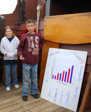
Students: Dakota, Gabrielle, Marije, & Rianne
Senior Crew Advisors: Doug Lyke & Kipp Van Aken
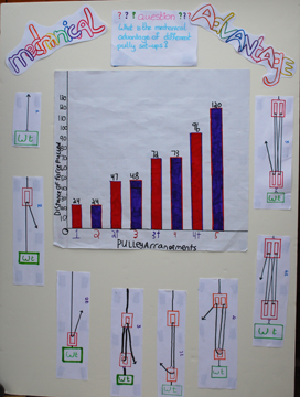
Guiding Question: What is the mechanical advantage of different pulley setups?
Instruments: Block & tackle simple machine, canvas bucket, bottle of water, tape measure, adhesive tape.
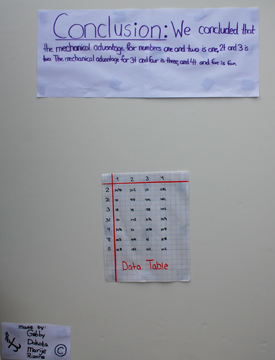
Conclusion: The mechanical advantage team discovered that as they added moveable pulleys to their block-and-tackle simple machine, the apparent force (effort) needed to lift the weight decreased, but that the length of line that needed to be pulled through the rig's pulleys increased in a predictable pattern. They were able to produce the ration of mechanical advantage for the various configurations of their machine, offering a means to predict, for example, exactly how long a line would be required to lift a given weight using a given amount of force.
|
|
|
Bar Graph: Distance of Force Pulled/Pulley Arrangements with Diagrams |
Data Table |
|
|
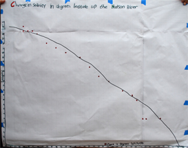
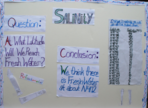
Research Team 3: Salinity
|
| 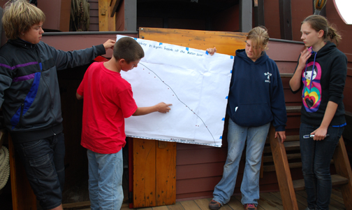
Students: Brian, Emily, Jeanine, & Wouter
Senior Crew Advisor: Scott Beiter
Guiding Question: At what latitude will we reach fresh water?
Instruments: Canvas bucket, sample jars, GPS unit, refractometer.
Conclusion: The salinity team found a clear pattern in the steadily diminishing salinity gradient of the Hudson as the Half Moon traveled upriver. Although the river water had still been slightly brackish at our northernmost sampling point (the Tappan Zee Bridge), the team was able to extrapolate from the existing pattern to offer a prediction that the ship would reach completely fresh water at approximately 41 ˚ 12' latitude, placing their prediction in Upper Haverstraw Bay, not far from where we would set anchor later that night.
|
|
|
Line Graph: Change in Salinity/Minutes Latitude |
Data Table |
|
|
|
|
|
|