 |
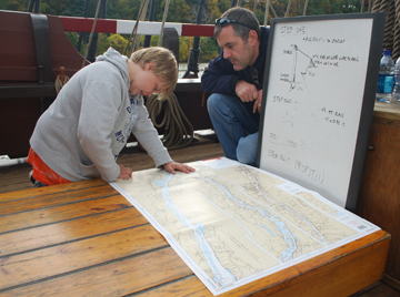
No matter what century you live in, it's always helpful to know where you are. Our student crew members examine both historical and modern charts of the Hudson River, learning how to read them to find landmarks, check water depth, and so on.
|
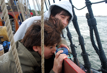
Our students also learn how to determine their position on a map. Using a hand-bearing directional compass, the crew sights three fixed, charted landmarks, such as bridges, river markers, or even tall buildings in a riverside community.
|
Mouse over to refocus.
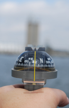 |
Students then plot the bearing (compass direction) of each landmark, drawing a straight line on the chart from the landmark's known position back in the direction of the ship. By marking three such bearings, crew members can triangulate their own location with a reasonable degree of accuracy.
This technique also invites additional areas of study. For example, for their research project, Dante and Erin had the entire crew take readings of various fixed markers along our route, then performed a statistical analysis of the variations in the crew's reported bearings (in effect, a study of human error).
|
|
|