2009 Masters Voyage of Discovery banner

River Science: Salinity

The Hudson River is an estuary: a freshwater river that flows into the ocean, where it mixes with salt water. The degree of mixture between fresh and salt water is called the salinity gradient. The salinity gradient at a given location can vary considerably depending on factors such as time of year, tidal flow, and precipitation. Salinity levels have an immediate effect on the surrounding ecology, since many aquatic creatures can survive only in either a marine, brackish, or freshwater environment. It's just as important for sailors (of any era), who need a fresh water supply to survive.

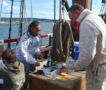
On this voyage, the research team of Isis and Sofia measured salinity levels on the lower Hudson for their presentation project.

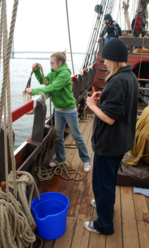
To measure the salinity gradient, our students collect water samples at regular intervals. On the Half Moon, we collect surface water samples the old-fashioned way: by simply heaving a tethered canvas bucket overboard and hauling it back on board. We started collecting samples at Newburgh, where the water was fresh (in other words, where the salinity gradient consistently reads as zero parts per thousand), and continued to collect samples through our arrival at the fully marine environment of Raritan Bay, also known as the lower New York Harbor.

Students use a refractometer to measure salinity levels using refraction: the degree to which light bends as it passes through different materials. Saltier water bends light farther than fresher water, so a trained refractometer user can check salinity levels with just a glance.

Sailors on board the original Half Moon in 1609 would have had simply gone by taste.

Voyage Homepage Daily Log Our Crew Learning Half Moon homepage